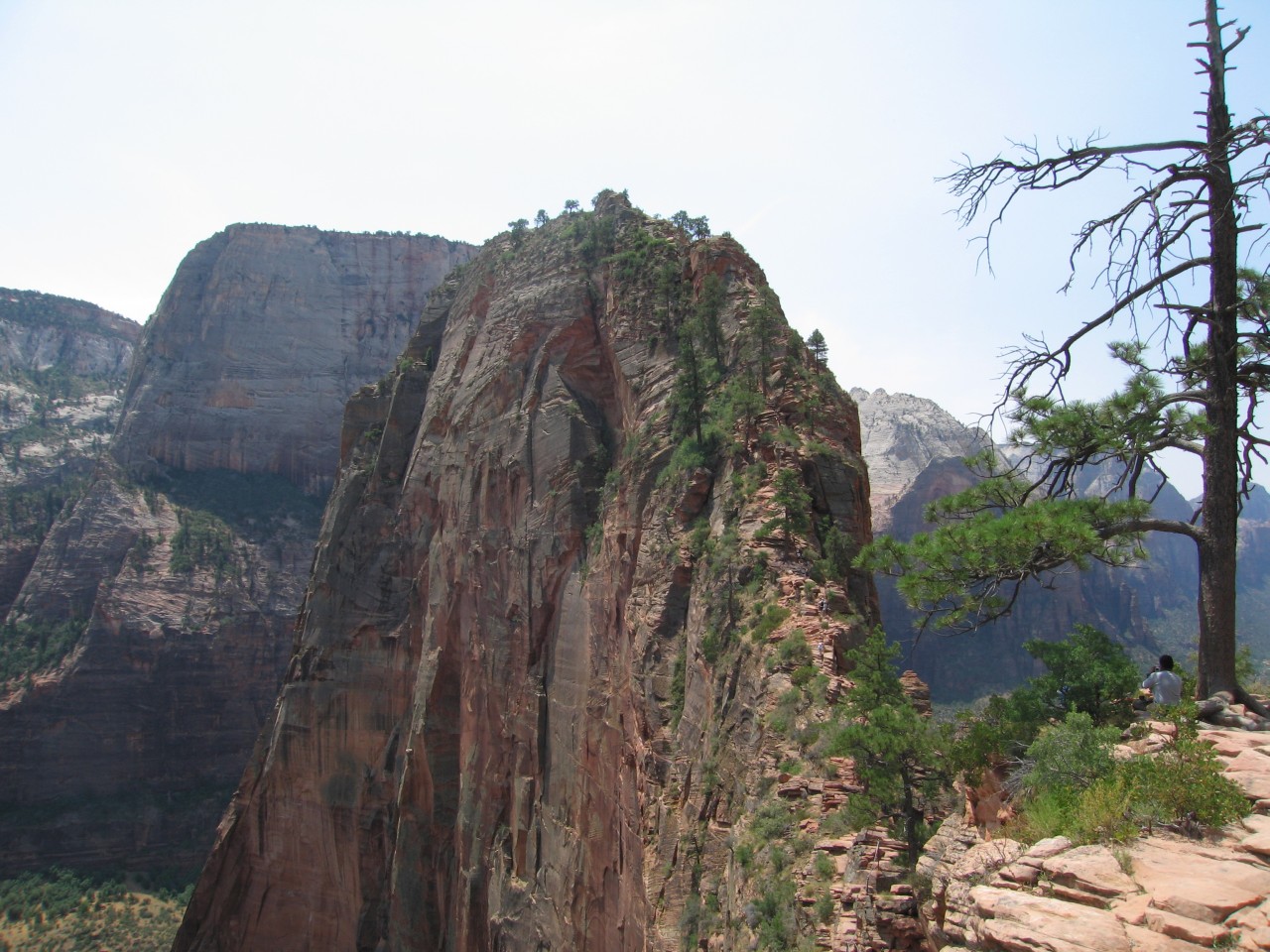
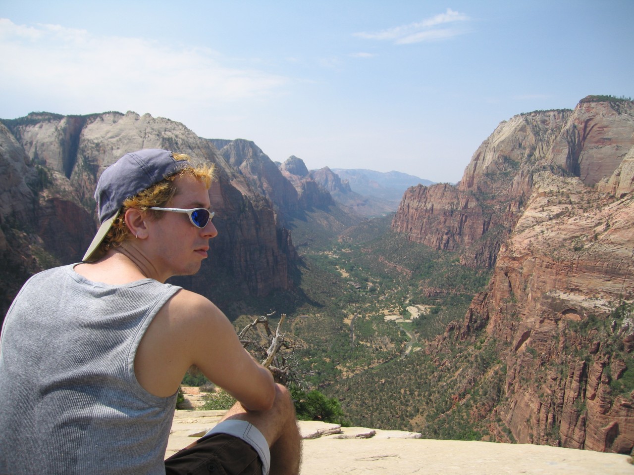
The ridge leading to Angel's Landing
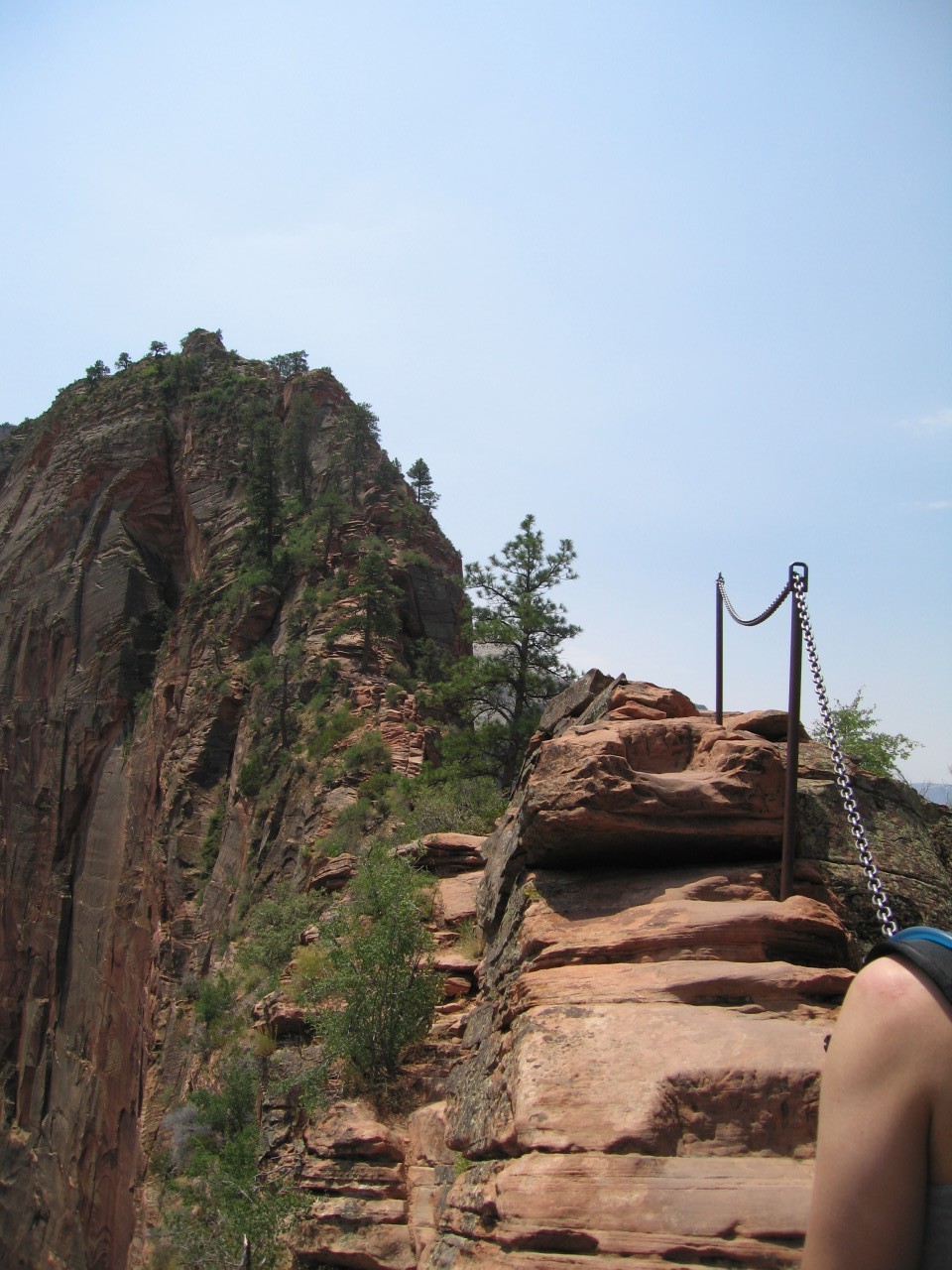
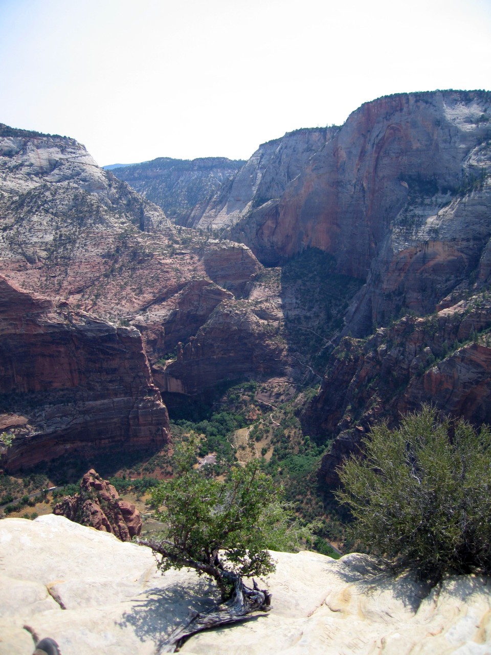
The tricky part
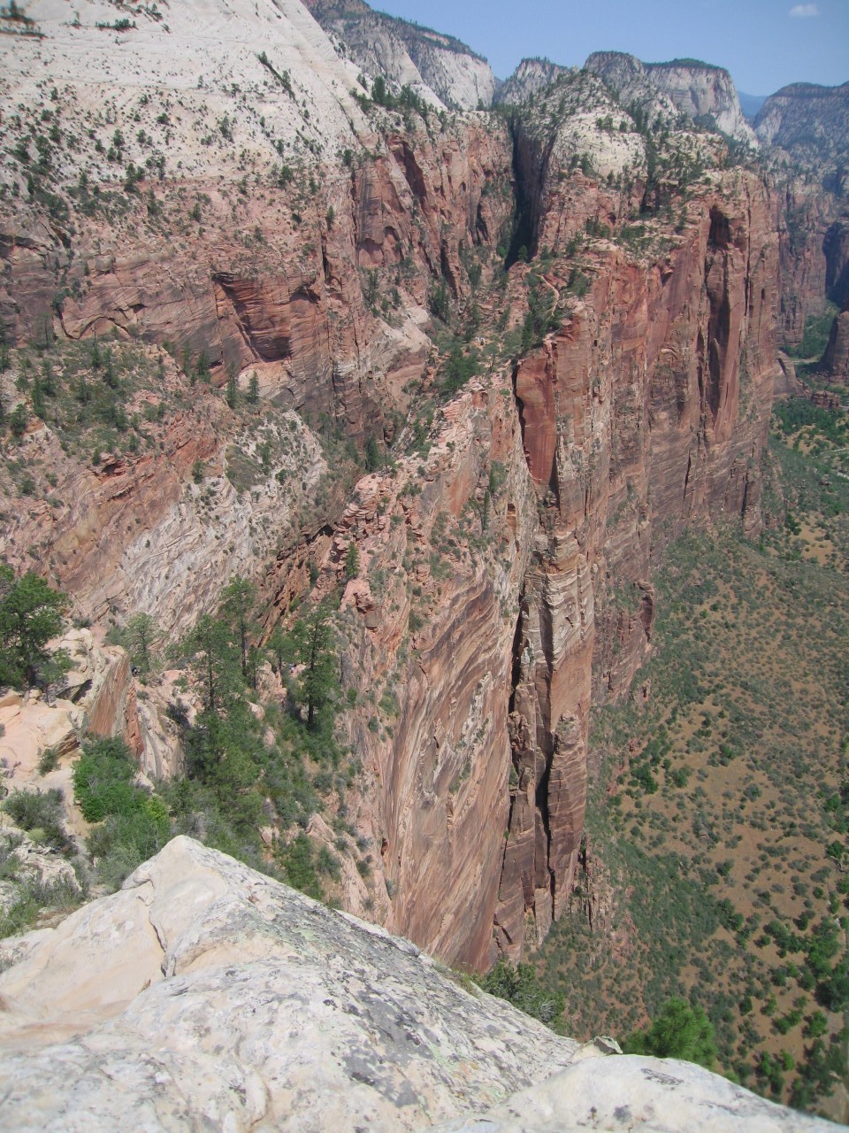
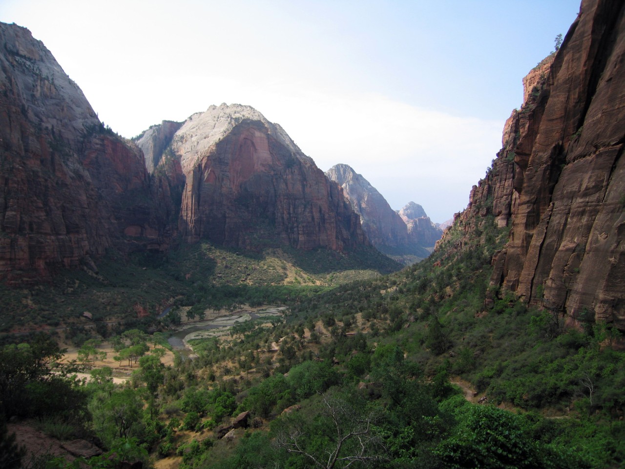
Looking back at the ridge
For our anniversary this year, we wanted to take an outdoorsy trip. Some of gems of the desert southwest are within an easy day's drive of LA. we'd visited the Paria River canyons before, but had never hit the national parks in the area, so that seemed like a fun thing. Plus we'd both read about Everett Ruess, a boy who explored the southwest alone in the 1930s, until he disappeared at age 20. A corral that he'd made in Davis Gulch was his last known location, so we thought we'd try to find it.
For more information on Everett, I recommend this book, Everett Ruess: A Vagabond for Beauty, a collection of his letters home, with some of his poetry and woodblock images.
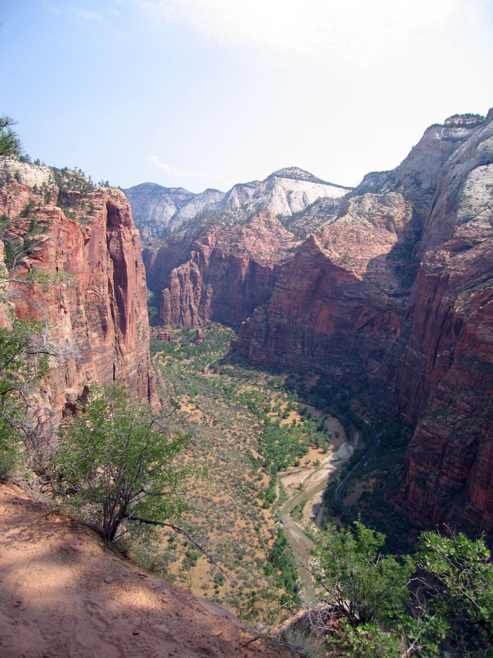
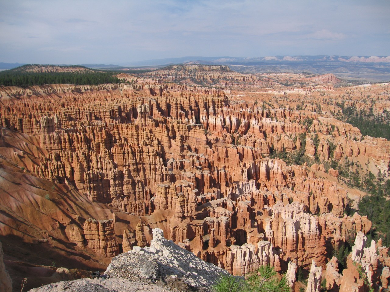
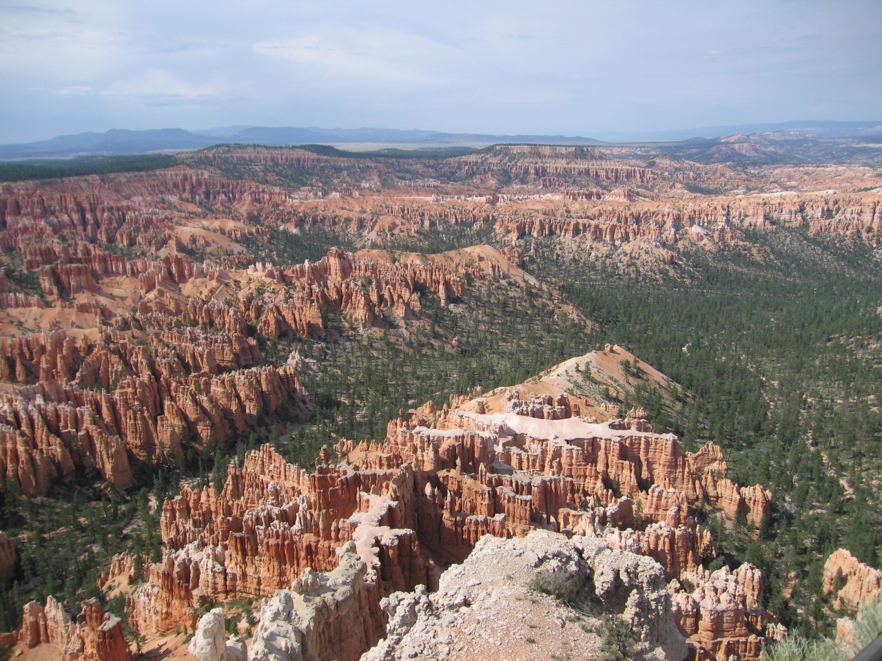
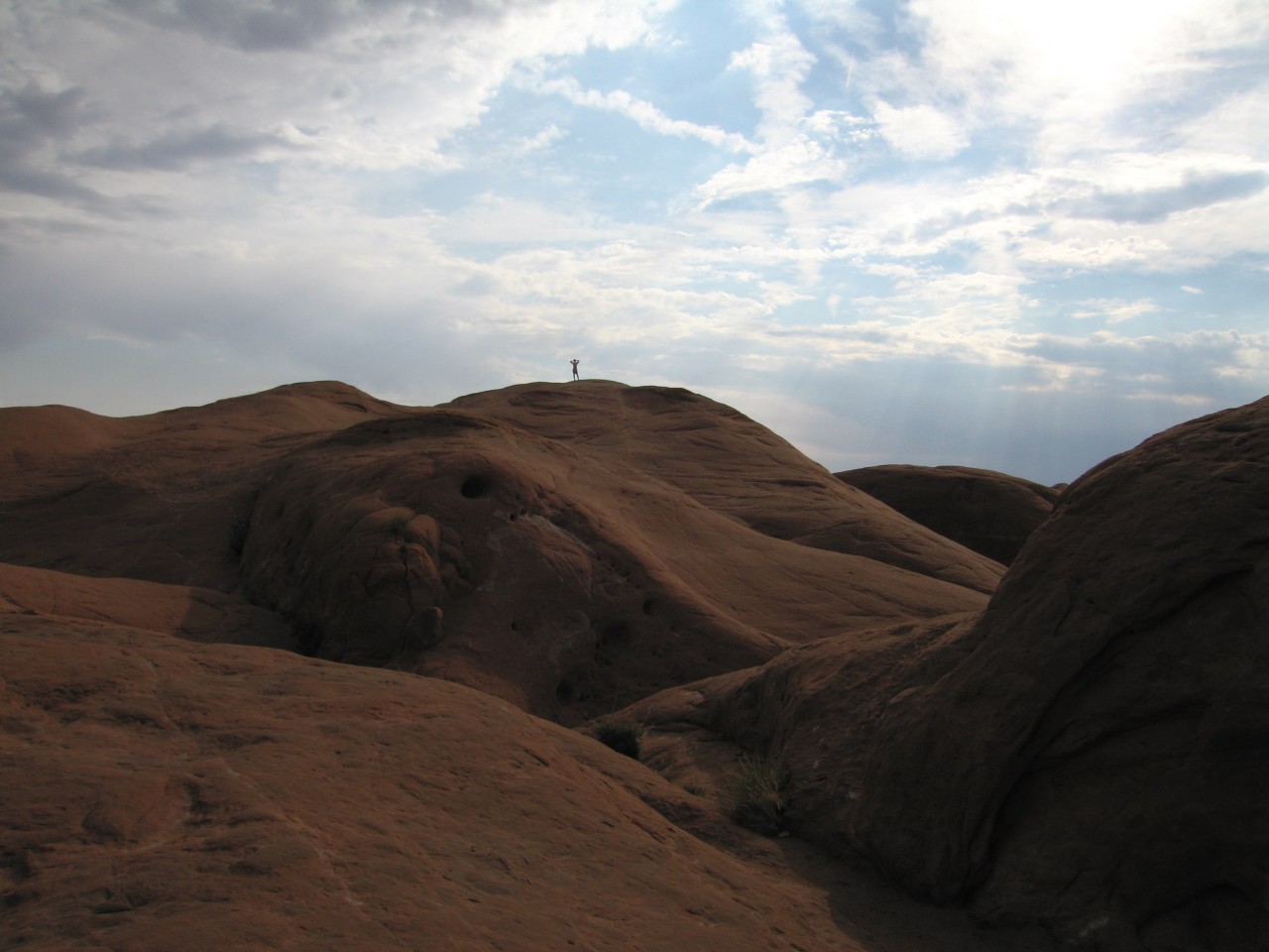
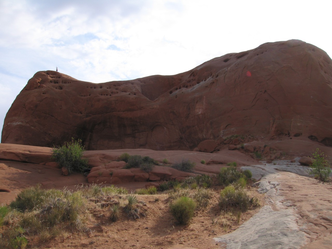
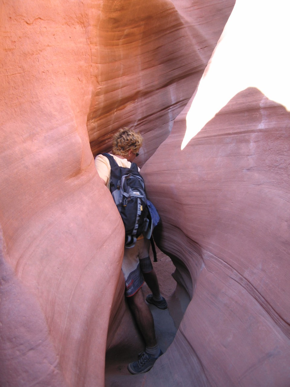
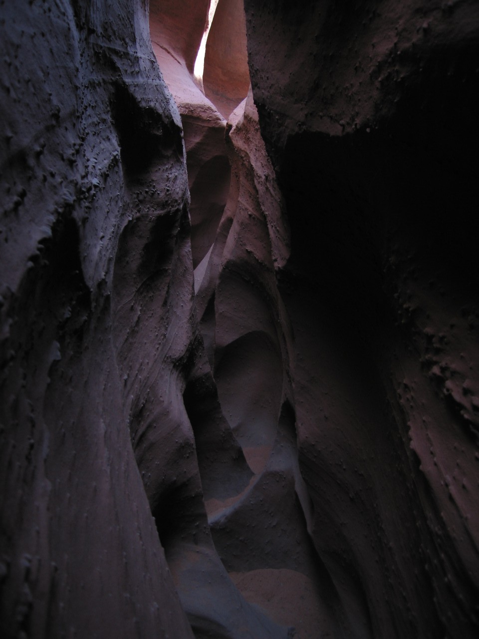
Zion National Park was the first stop. We only had the day there, and decided to tackle what sounded like the most spectacular of the short dayhikes, Angel's Landing. This trail climbs from the valley floor up to the top of a 1200 foot tall rock formation, which has spectacular views up and down the main valley of Zion. The trail starts out as a set of steep switchbacks, and then proceeds along a very narrow ridge with a steep drop on both sides. At one point, the trail is only about the width of a sidewalk, but there is a chain bolted to the rock to keep you steady.
|
The ridge leading to Angel's Landing |
The tricky part |
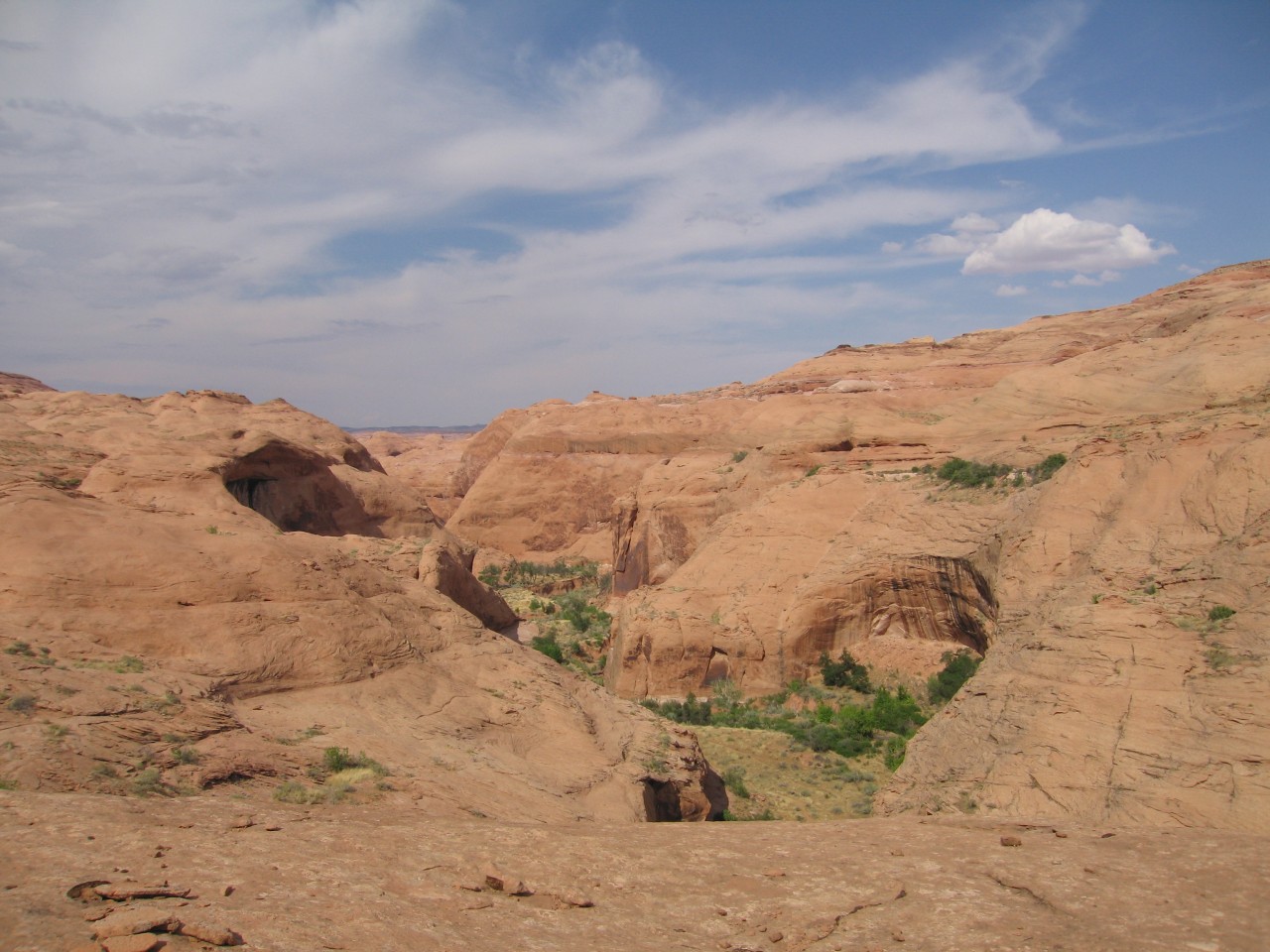
Looking back at the ridge |
 Upcanyon, deeper into the park |
 The view downcanyon |
 Switchbacks leading to a side canyon |
 About halfway down |
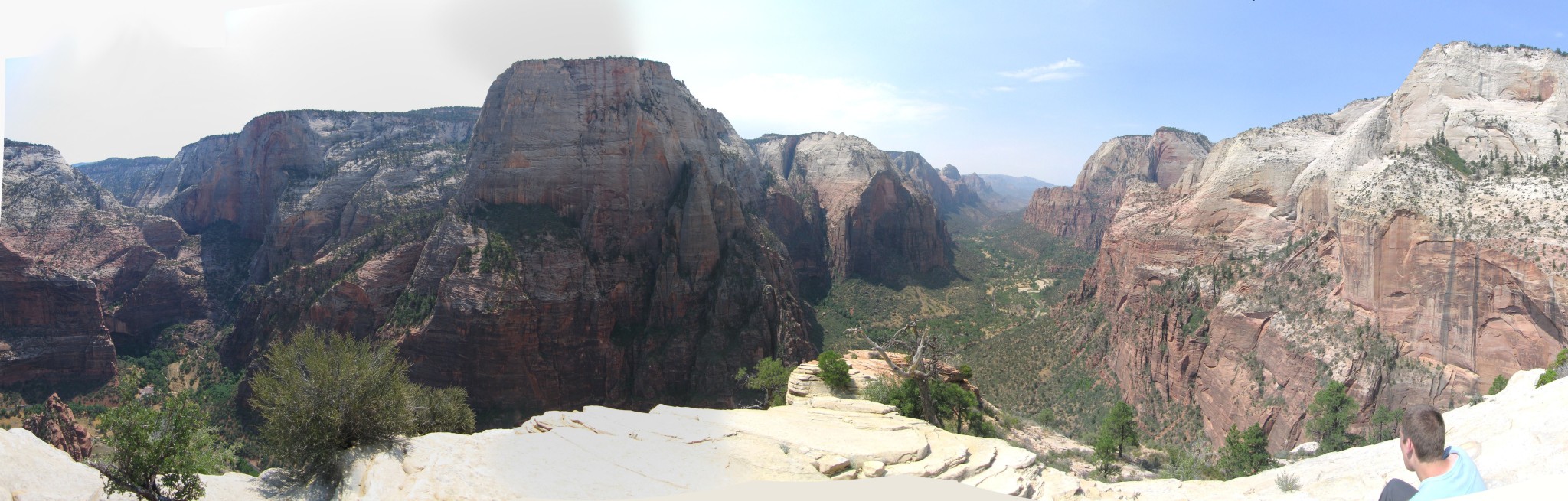 Panorama from the top |
Little did I know then, but I'd be climbing up those switchbacks in the sixth image about two years later.
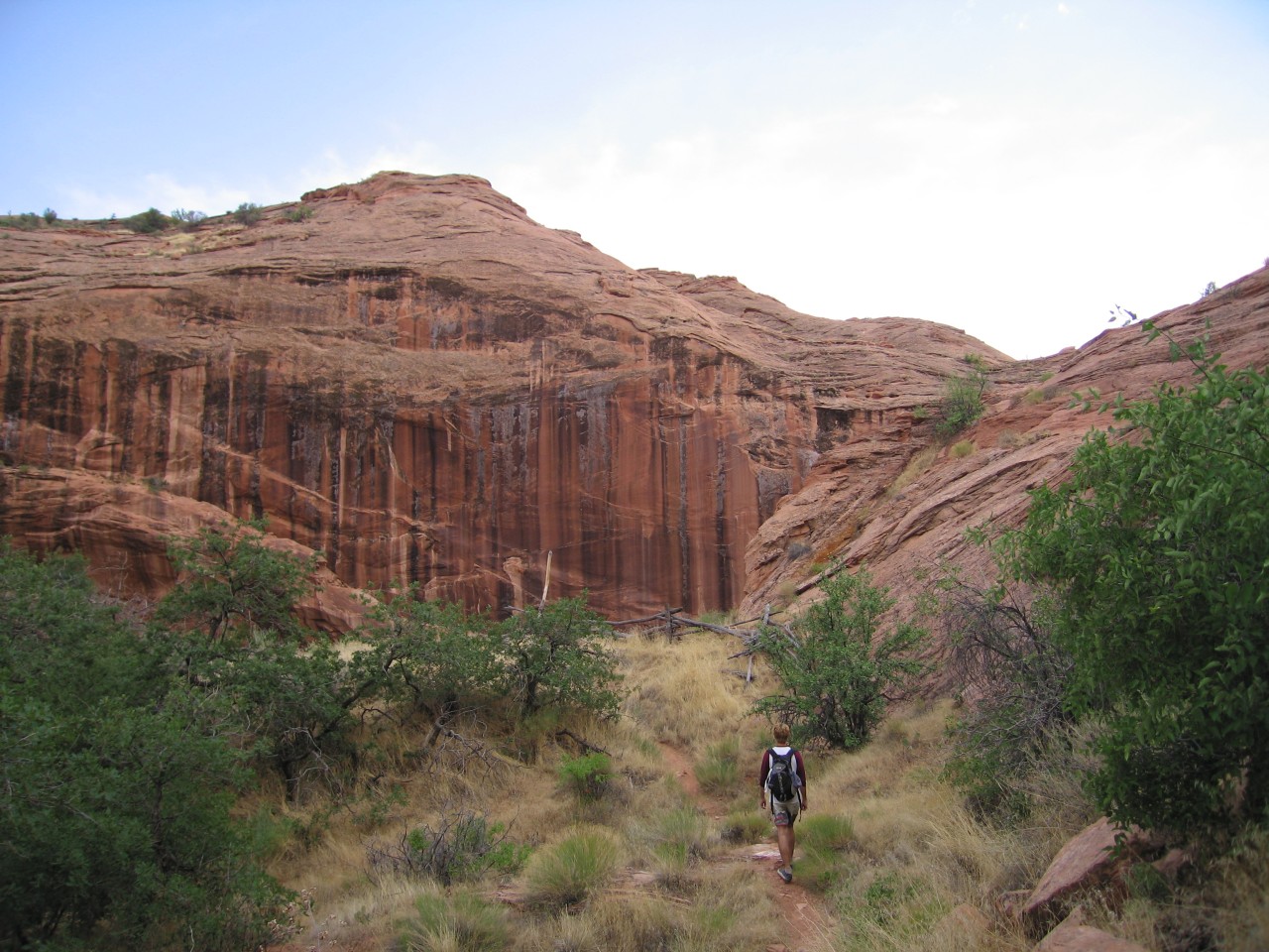
On our return trip through the park, we did the Zion Narrows hike, which is a hike in the Virgin River, at the end of Zion Canyon. The river nearly fills the canyon, and you're hiking at the bottom of steep, beautiful cliffs, continually crossing from side to side in the cool water, following the small strips of dry land. We intended to reach the junction with Orderville canyon, and then hike up that to the waterfall, the section that does not require a permit. It started to rain though, and since the canyon is prone to flash floods, we decided it would be best to turn around and try again another time, which happened on our third trip here, about three years later. No pictures this time, since they were on a disposable waterproof film camera, but the later trip has some.
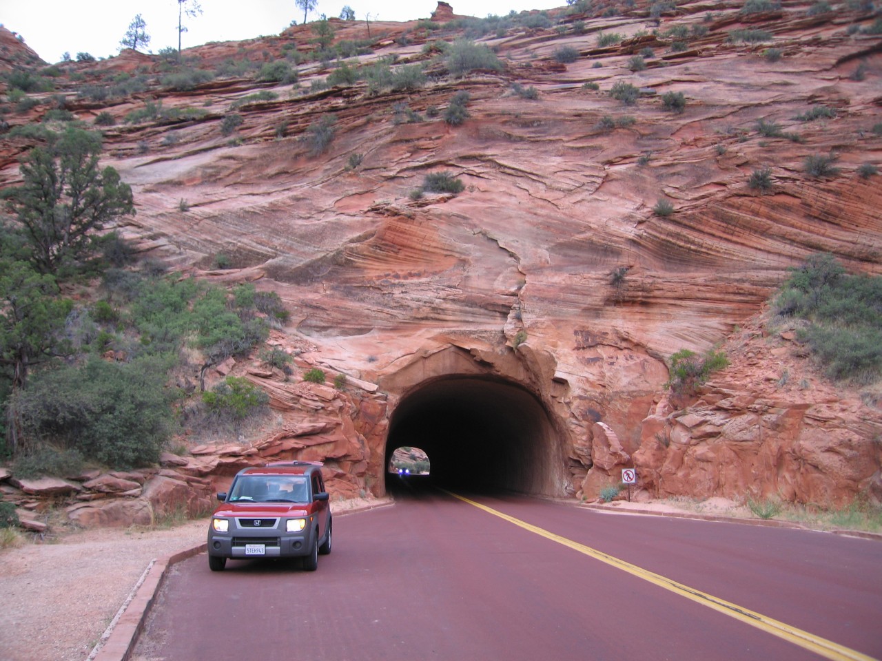
Zion has some a couple of tunnels that were dug straight through the rock. One is quite long, and necessitates the use of a window in the rock to keep the air circulating. The tunnels are just large enough for two lanes of cars, but only one lane of large vehicles (like some RVs). If you're driving through with a large vehicle, then you have to hire a park escort to shepherd you through and stop traffic.
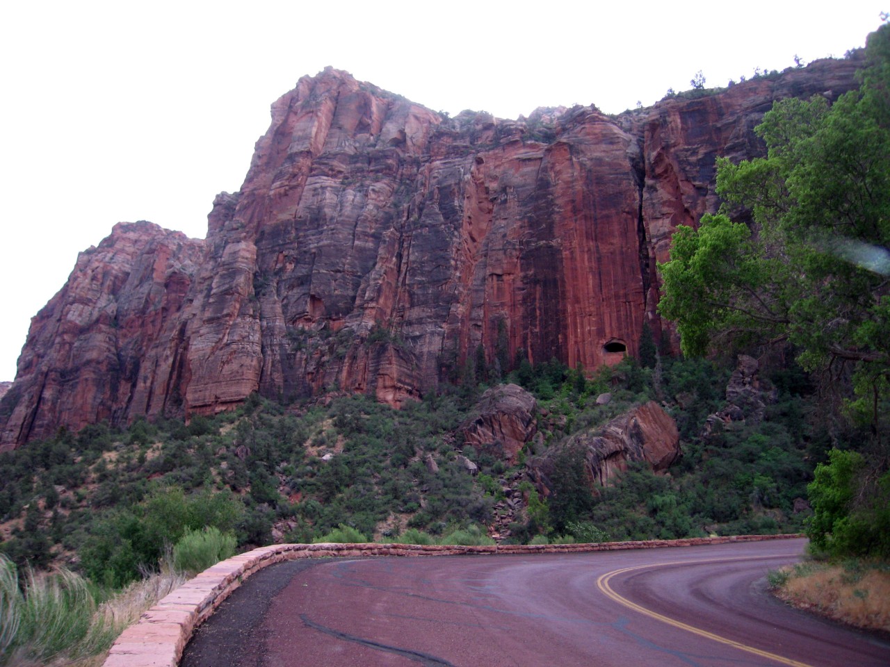
 The short tunnel |
 The window for the long tunnel |
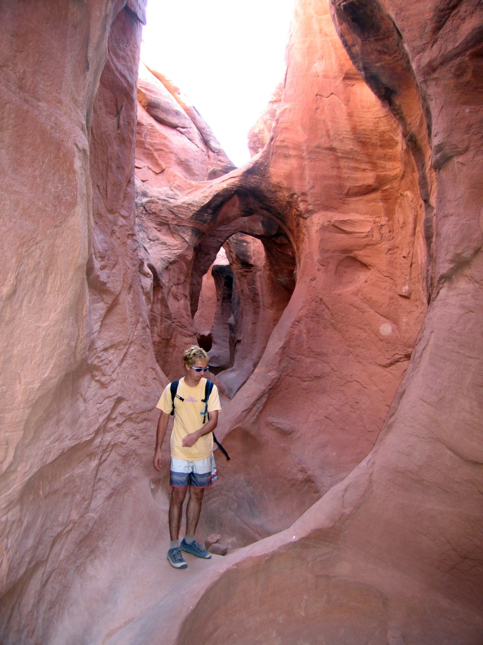
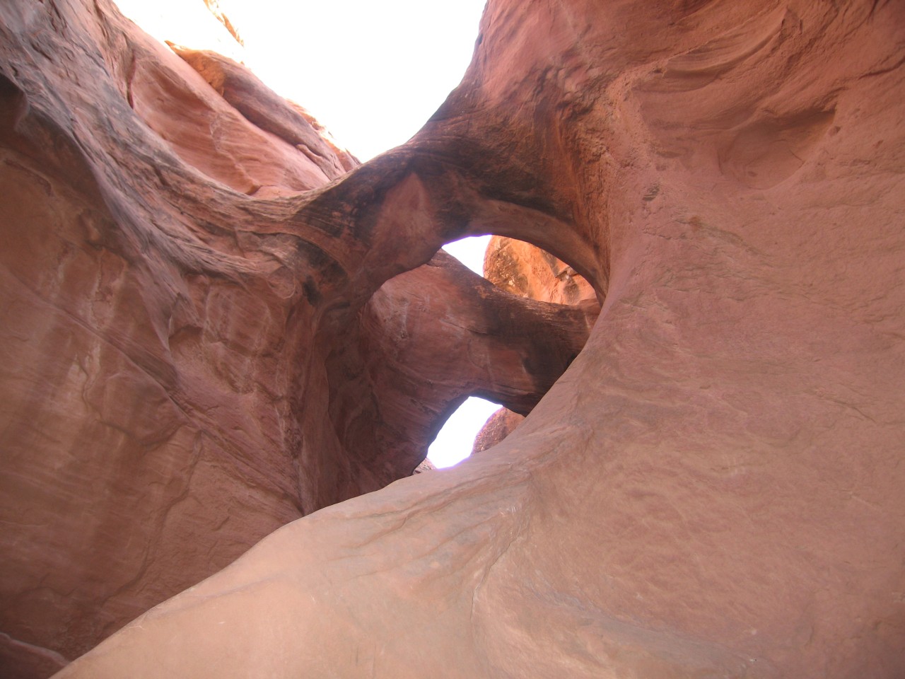
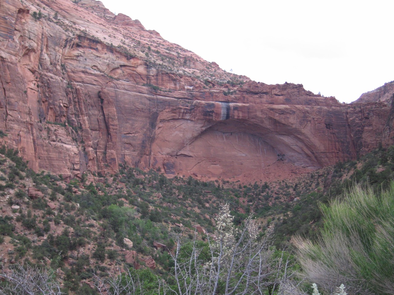 An arch in progress |
On our next trip here, two years later, we hiked from the far side of the long tunnel to the top of the arch in the third picture and had a great view into the valley.
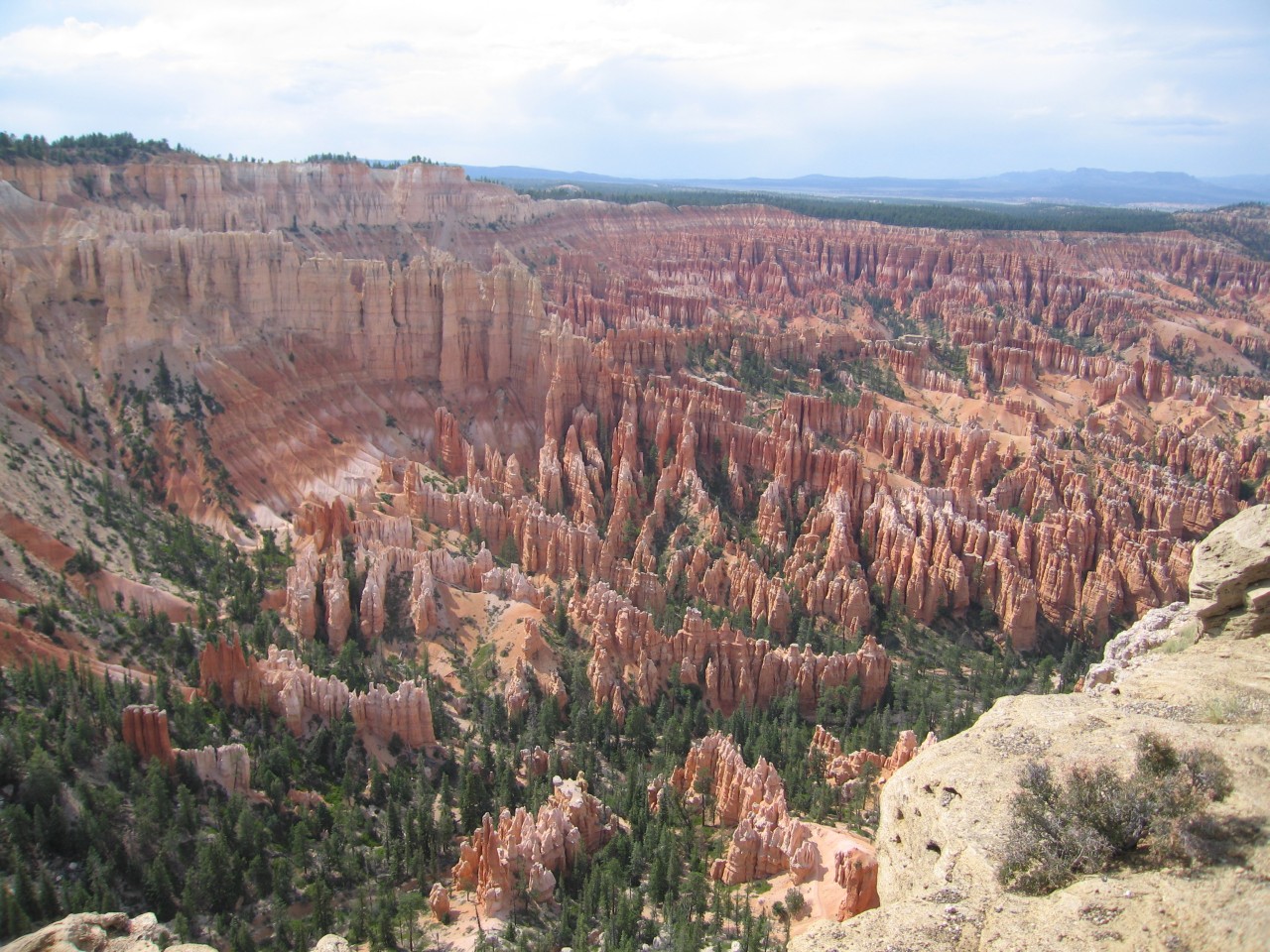 Bryce |
 More Bryce |
 Still more Bryce |
 All alone |
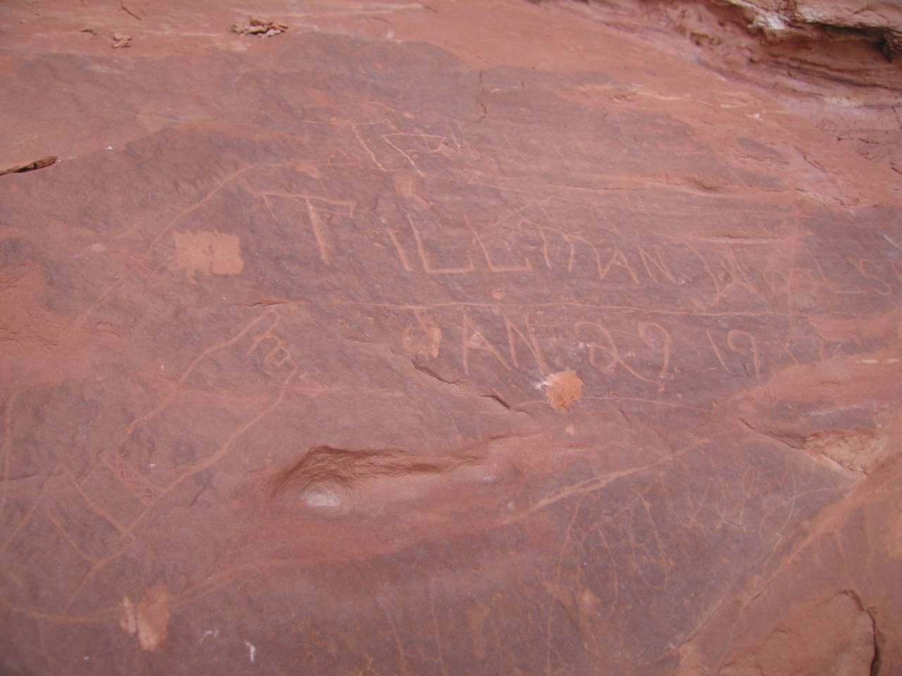 Graffiti at Dance Hall Rock |
 Danny climbing the hills |
 Ryan on top of Dance Hall Rock |
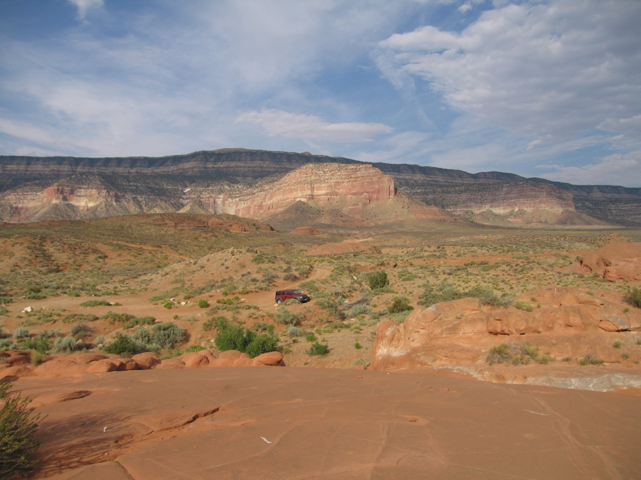
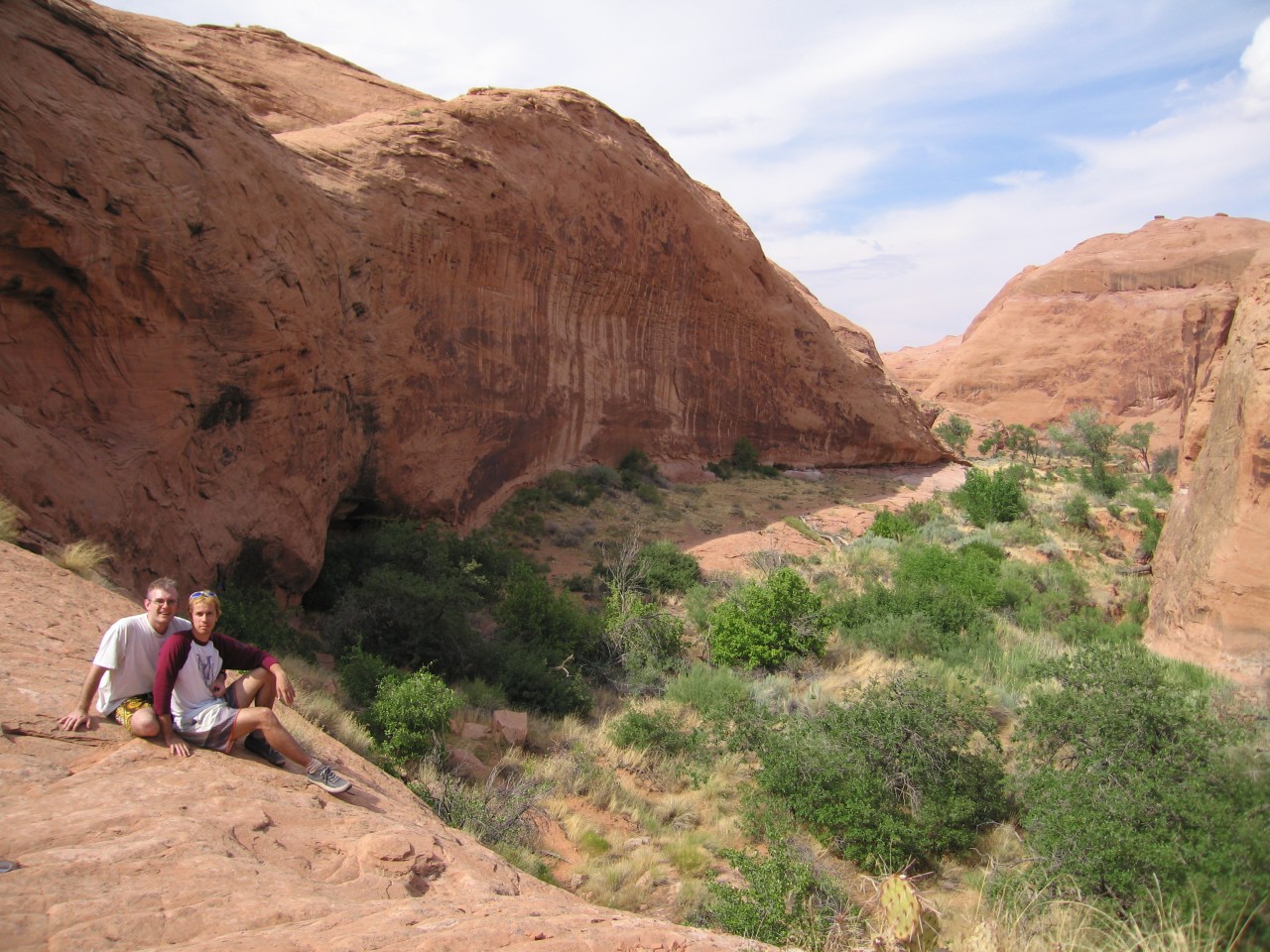
The parking area for Davis Gulch was not hard to find with the directions and topo map that we had. There were two ways to get to the section we wanted - we could enter Davis Gulch at the beginning, very close to the road, or we could hike overland and enter at the spot that Everett used. We had some information that the beginning of the canyon would be slow going, with a lot of climbing over boulders, and a slow hike through the brushy canyon floor to get to the destination. Again, time was short, so we decided on the overland hike. Since this was July in the desert, it was quite hot, but we had lots of water. I had some GPS coordinates, so we didn't need to parallel the windy canyon, and could just pick the best route across land. Even so, the 3.5 mile trek wasn't easy. There were a few cliffs to find a way down, and the route was hillier than the topo map had led me to think.
Even with the GPS coordinates and a good map, it took a bit to find the right way down into the canyon. But there was the corral. We looked around for a while, and found a small overhang partially obscured by brush just around the corner from the corral. It might have made a good shelter for rainstorms, and we wondered if we might be standing in one of Everett's last campsites. I'd heard there was a rock somewhere in the canyon that had a "Nemo" sign-in of Everett's, and although we did find a wall with a lot of other graffiti carved into it, we didn't find a Nemo.
 Davis Gulch |
 The corral |
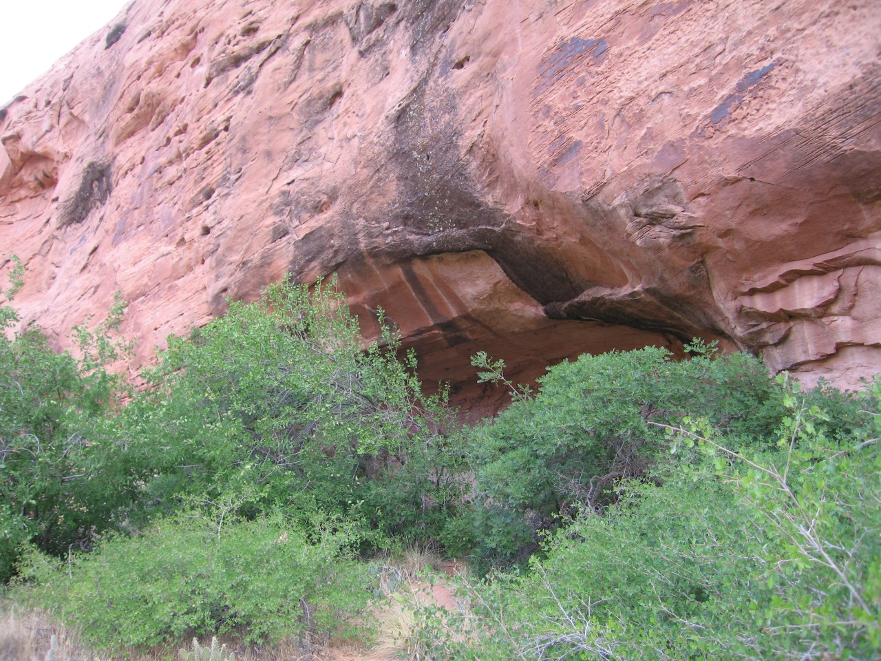 Overhang campsite? |
 Entrance to Davis Gulch |
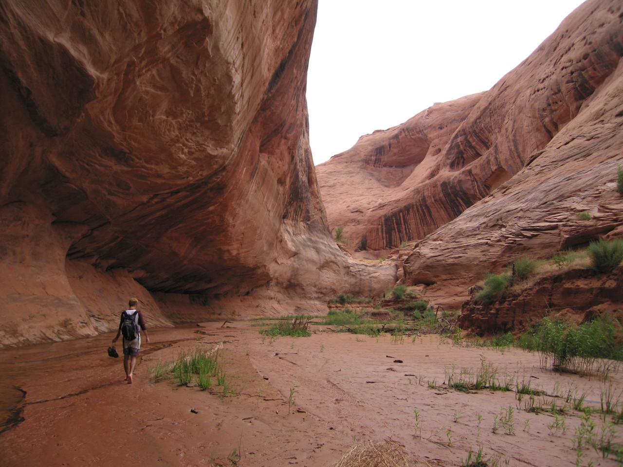
We hiked down the canyon, wondering if we'd be able to get to the end of Davis Gulch and see the main, water-filled canyon. Hiking through the canyon was definitely slower than on the top - the bottom had sandy cliffs to climb up and down (and get in your shoes) and places of thick brush. We found a small waterfall which emptied into a pool that was just right for a cooling swim. Shortly downstream of that, the water started to deepen, and we turned a corner and surprised a party of boaters who had come from Lake Powell. They told us it was still a ways out of the gulch. We went on around the corner (swimming, because it had gotten that deep), just to take a peek, but decided to turn around at this point.
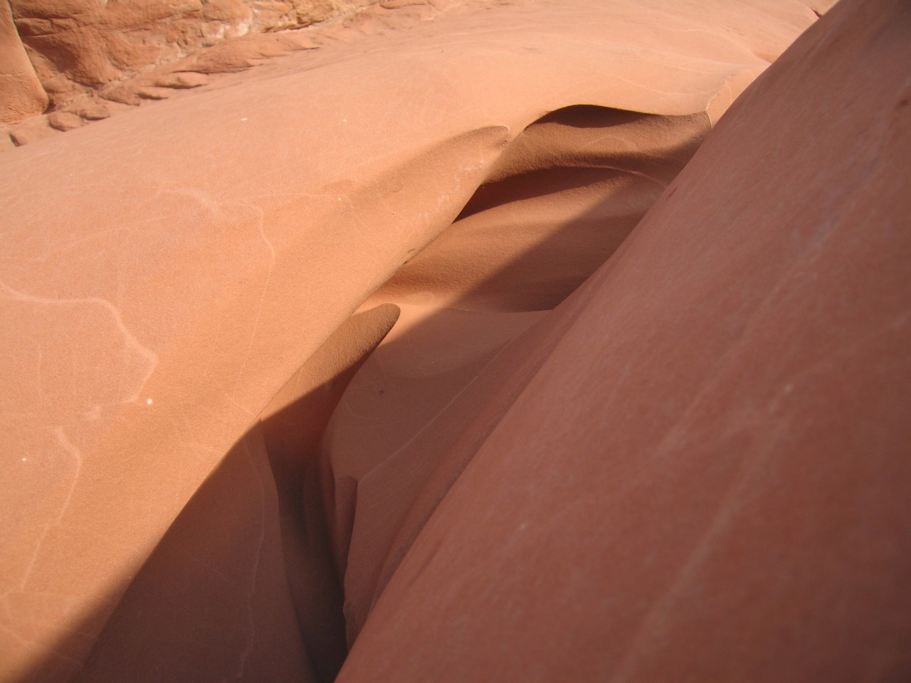 Pretty sandstone |
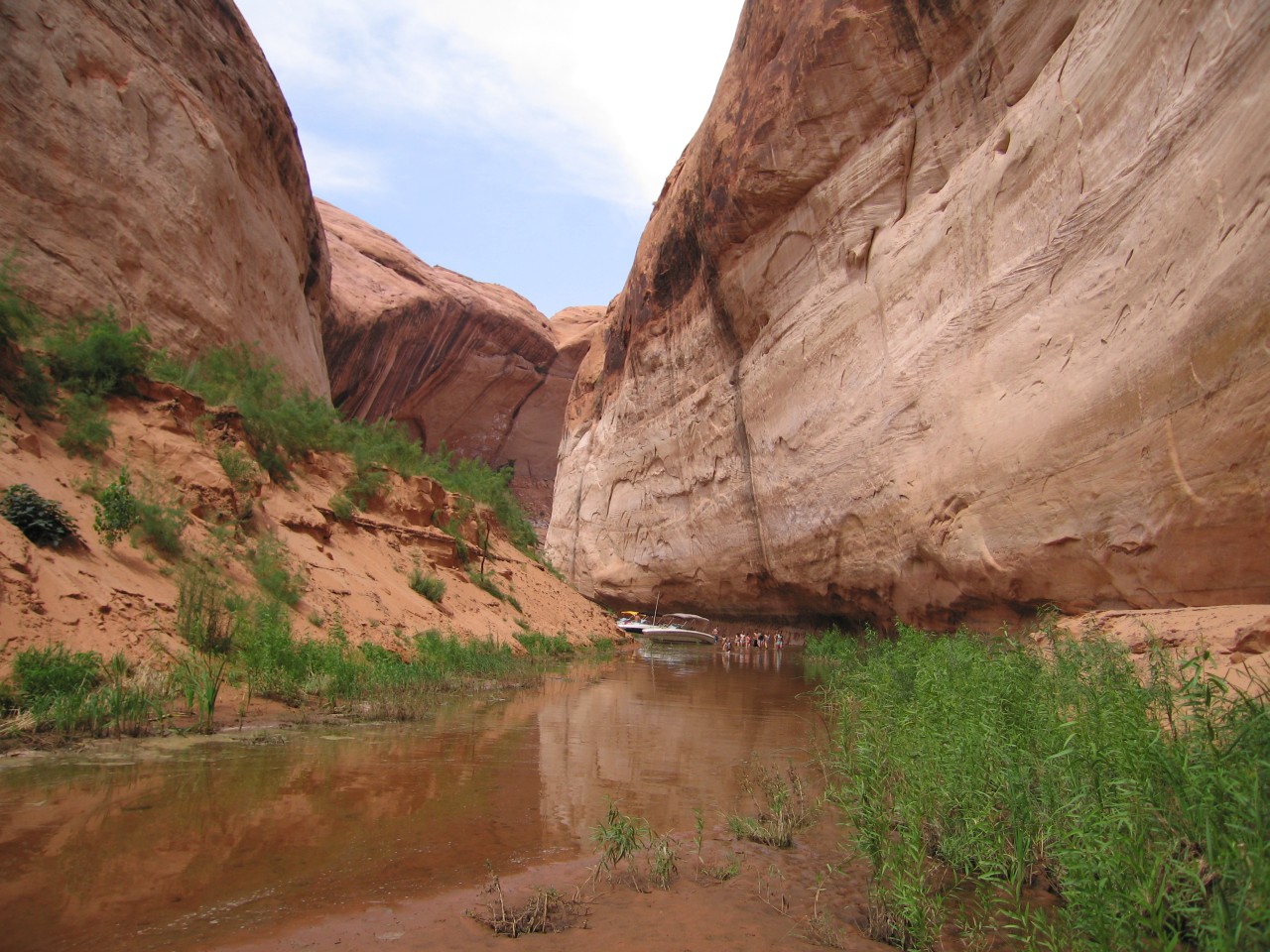 Boaters |
 A section of easy walking |
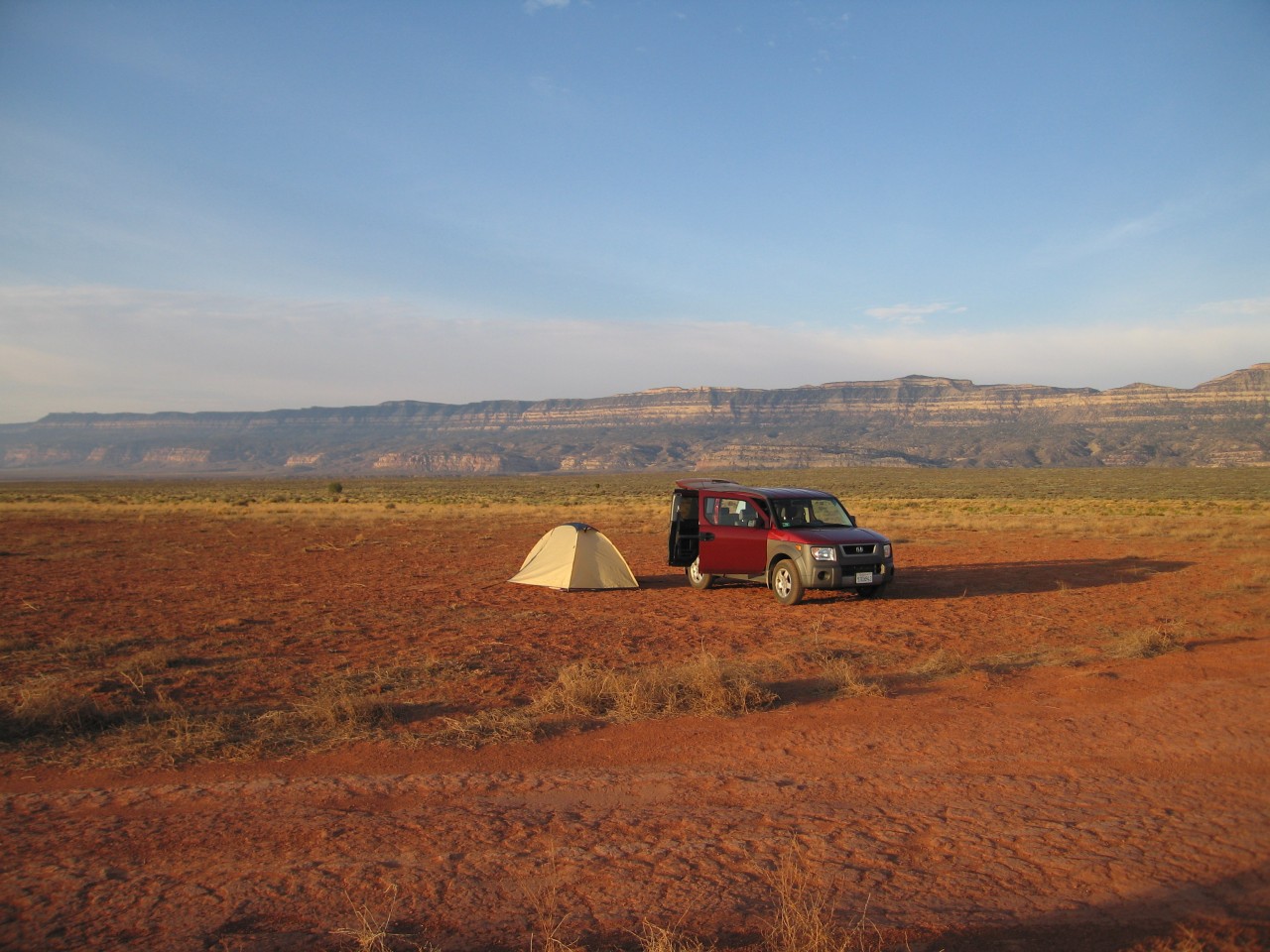
After making our way back to the car, we drove back a ways and found a camping spot. The next day, we visited some slot canyons that were off the side of Hole-in-the-Rock Road, Spooky Gulch, Peek-a-Boo, and Brimstone Gulch. Peek-a-Boo is a really fun canyon, not far from the trailhead. It's a smooth canyon, and has a couple of holes plus a rare double arch. Spooky is a much narrower canyon, with rough walls in places. We continued on to Brimstone Gulch, but I think our energy and sun tolerance were flagging at that point, since it involved another 2 miles through sand and rock streambeds, so we never made it all the way to Brimstone.
 Practically a Honda Element ad |
 Danny Peek-a-Boo |
 The double arch |
 Danny twisting through the end of Peek-a-Boo |
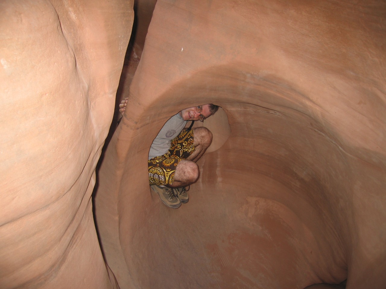 Ryan in Peek-a-Boo |
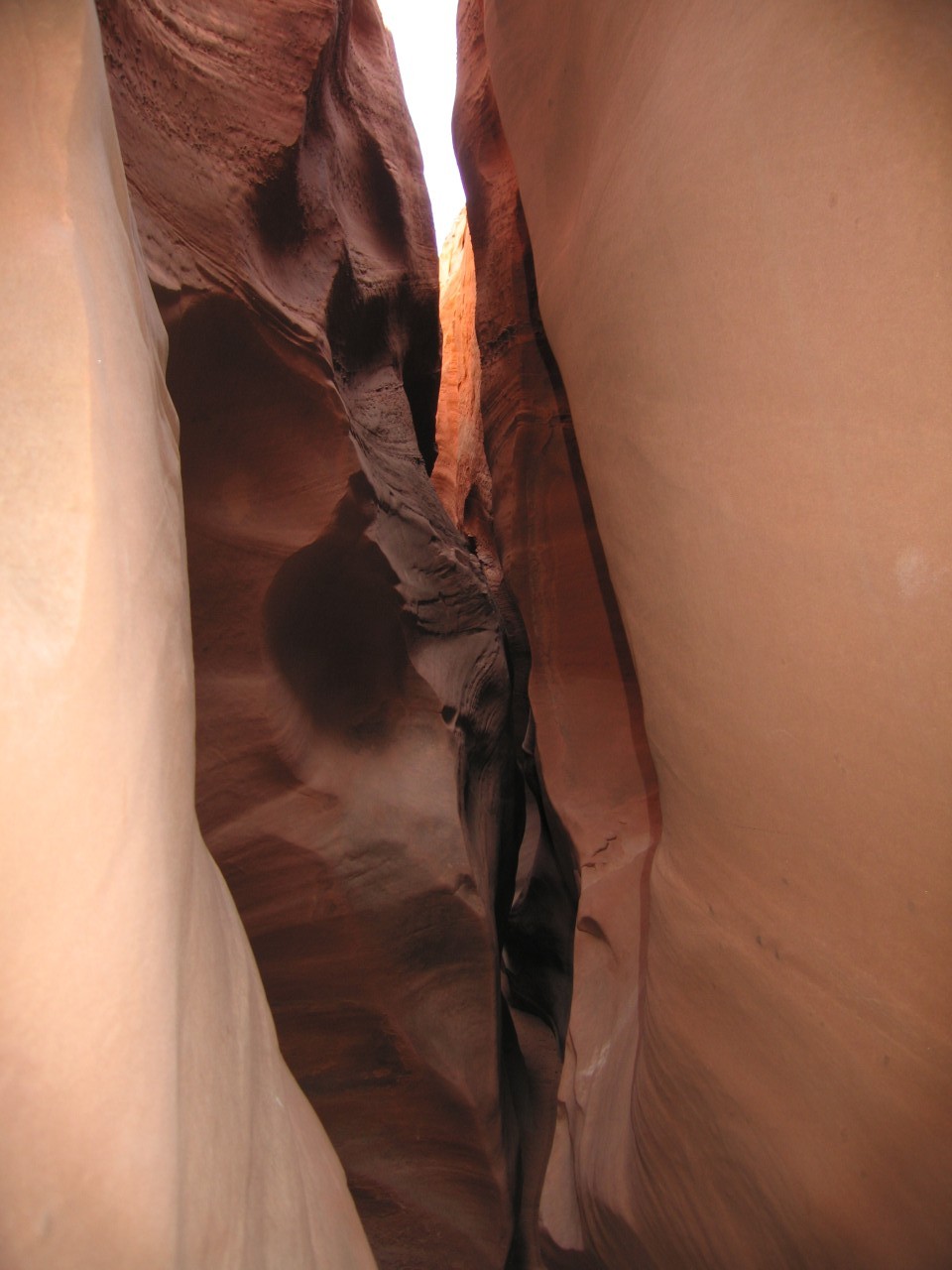 Spooky Gulch |
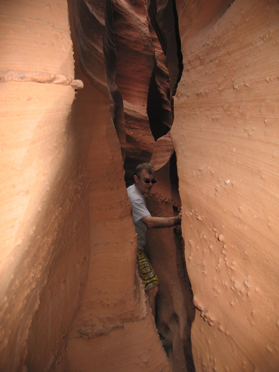 Ryan squeezing through Spooky |
 Spooky Gulch gets spooky |
On the way back, we had a celebratory anniversary evening in Las Vegas by watching the amazing Ka show and staying at the Mandalay Bay. In the morning we played around in Mandalay's waterpark-like pool complex, and had the scrumptious buffet brunch at Le Village in Paris before heading back to LA.
Other trips